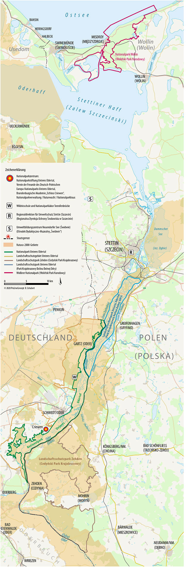
Oder estuary
The map shows the entire Oder estuary, i.e. the estuary area of the Oder, which begins at Hohensaaten when the unobstructed Oder, past the Oderbruch, squeezes through the narrowness of the Neunhagener Insel. The Oder estuary to the north is practically at sea level, so there is hardly any gradient. The Oder, which originally meandered in this estuary, with its numerous old and secondary arms, was brought into its current, polded form by Dutch experts at the beginning of the 20th century.

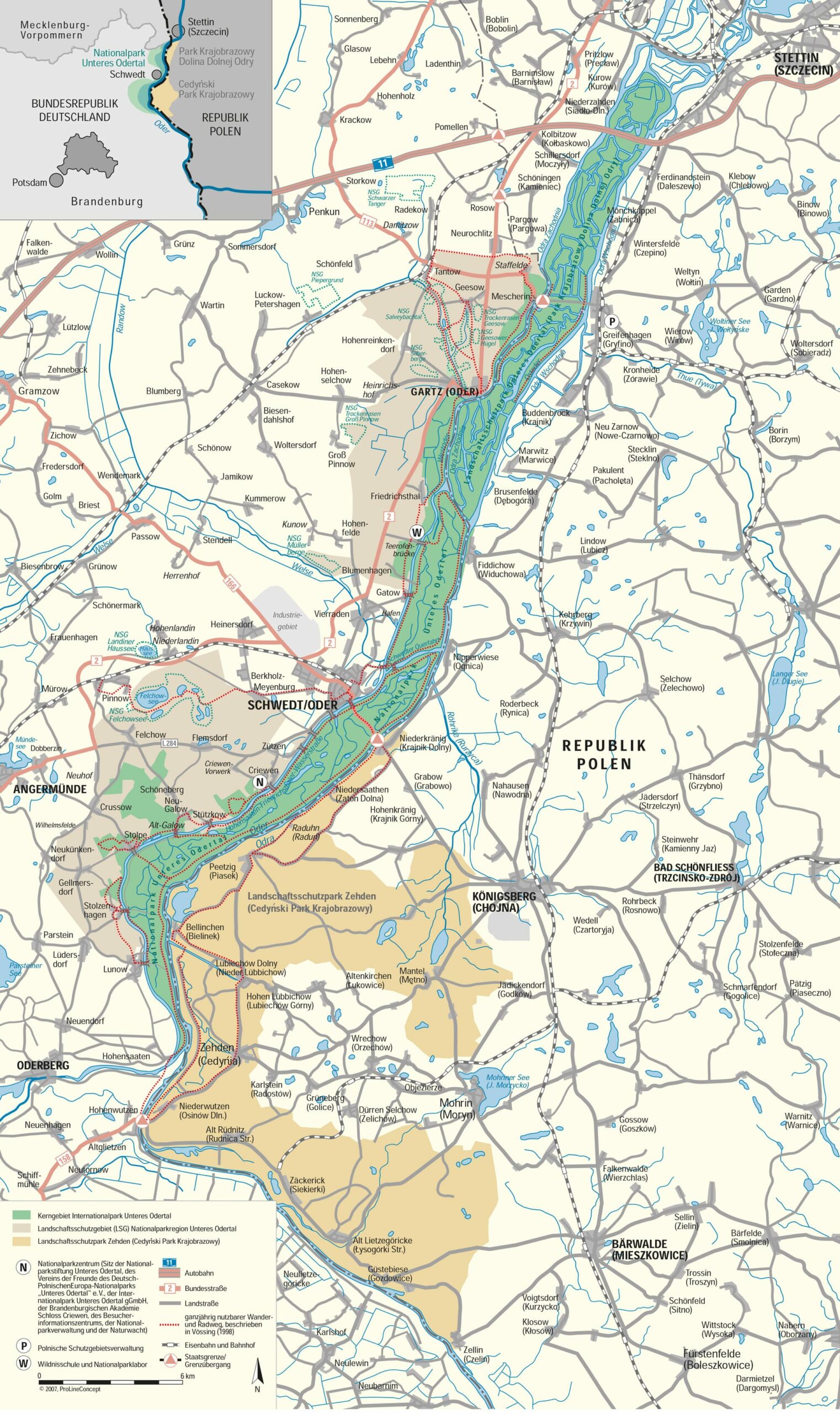
International Park Lower Oder Valley
The map shows the German-Polish International Park, which was founded by a joint declaration by Poland and Germany in 1993. On the German side, it includes the Lower Oder Valley National Park and the Lower Oder Valley Landscape Protection Area and on the Polish side the Zehden Landscape Protection Park (Cedynski Park Krajobrazowy) and the Lower Oder Valley Landscape Protection Park (Park Krajobrazowy Dolina Dolnej Odry). This cross-border, European, especially German-Polish area covers a total of 117,274 hectares.

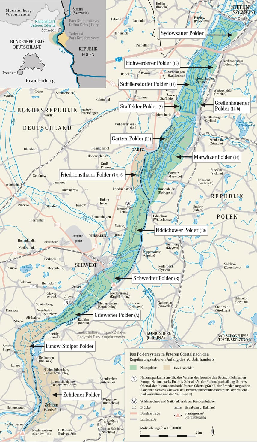
The polders in the Lower Oder Valley
At the beginning of the 20th century, the lower Oder valley was restructured by Dutch experts, the Stromoder was placed on the eastern edge of the valley, and the old Oder and the Wels estuary were redesigned with a few canal cuts to form the Hohensaaten-Friedrichsthal waterway. In between came several hundred kilometers Old arms to lie. There were both Dry polder created that are not flooded all year round, such as the Lunow-Stolper Trockenpolder or the Friedrichsthaler Trockenpolder (5/6), but also so-called at the request of local agriculture Wet polder , which are flooded in the winter half of the year by open inlet and outlet structures by the then usually higher standing Oder water and bring organic fertilizer to the meadows. On the German side, the technical structures were brought up to date after reunification at an extraordinarily high cost. On the Polish side, hydraulic engineers are planning something similar, although the polders have not been maintained since 1945 and have in fact been returned to nature as secondary wilderness.

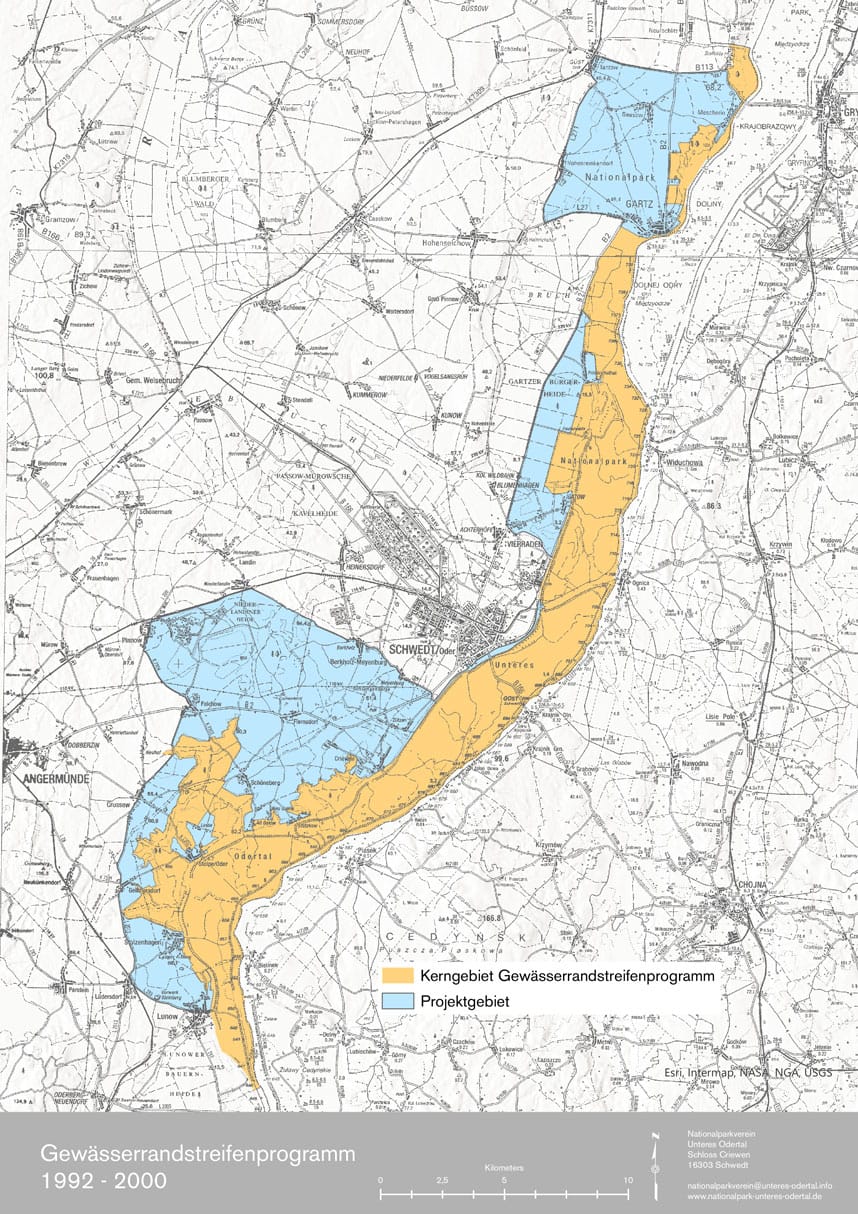
Large-scale nature conservation project of nationwide representative importance (riparian strip program)
Large-scale nature conservation project of nationwide representative importance (riparian strip program)
In 1992 the Federal Environment Ministry started under the direction of Environment Minister Prof. Dr. Klaus Töpfer, and the Federal Agency for Nature Conservation (BfN), under the direction of Prof. Dr. Martin Uppenbrink, together with the State of Brandenburg, represented by Environment Minister Matthias Platzeck, the largest at the time Large-scale conservation project of national representative importance, with a financial volume of 60 million DM. The map shows the planned zoning, i.e. the core area with a size of approximately 11,500 hectares and the project area. That Riparian strip project was unilaterally and prematurely canceled in 2000 by the then Agriculture Minister Wolfgang Birthler (SPD), the funds made available for Brandenburg flowed back into the federal budget. However, it remains the basis for the use of funds by the Association of Friends of the German-Polish European National Park Lower Oder Valley e.V.
")
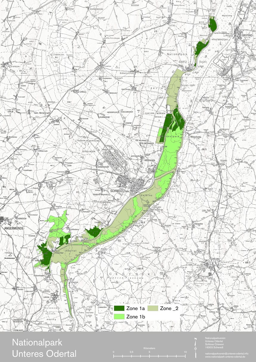
Lower Oder Valley National Park
In 1995 and then amended in 2006, the so far only Brandenburg national park in the lower Oder valley was founded by Brandenburg state law. The map shows the approximately 10,500 hectare national park area as well as the zoning that has existed since 2006. Zone I (50% of the national park) should develop as a so-called total reserve to a secondary wilderness. While Zone Ia will be withdrawn from any use immediately, Zone Ib will only develop in perspective. Zone II (also 50% of the national park, i.e. a good 5,000 hectares) should continue to serve the protection of species and biotopes and be used extensively for agriculture in the long term.